16 November 2025
In a revelation that fundamentally reshapes our understanding of the planet we call home, a consortium of international scientists has announced the discovery of the most massive mountain range on Earth. Yet, in a twist of cosmic irony, these staggering peaks will never be summited by human climbers, nor will their silhouettes ever be captured by a camera, for they lie entirely hidden from view, deep within the Earth’s mantle. This colossal subterranean range, dwarfing the visible Himalayas, is reshaping the very field of geology and forcing a rewrite of textbooks.
The discovery, published today in the journal Science Advances, is the culmination of decades of seismic research. The key to “seeing” these internal structures lies in analyzing the seismic waves generated by massive earthquakes. Just as a sonar uses sound waves to map the ocean floor, seismologists use the energy from quakes to create a detailed, three-dimensional tomographic image of the Earth’s interior. When an earthquake occurs, it sends shockwaves radiating through the planet. The speed and direction of these waves change depending on the density, temperature, and composition of the material they pass through. For years, seismologists have noted peculiar zones at the boundary between the Earth’s molten outer core and the solid lower mantle, roughly 2,900 kilometers (1,800 miles) beneath the surface. Here, the waves would suddenly slow down dramatically, indicating the presence of incredibly dense, mountainous topography on the underside of the rocky mantle.
Dr. Evelyn Reed, the lead seismologist from the University of Cambridge, explains the process: “Imagine we are using the planet’s own vibrations as a powerful CT scan. The data we’ve collected from hundreds of seismic events points to vast, complex structures towering from the core-mantle boundary. We’ve moved from seeing vague ‘blobs’ to mapping intricate topographies with peaks and valleys on an unimaginable scale.” These structures, formally known as Ultra-Low Velocity Zones (ULVZs), are now recognized not as isolated bumps, but as parts of a continuous, globe-spanning mountain range.
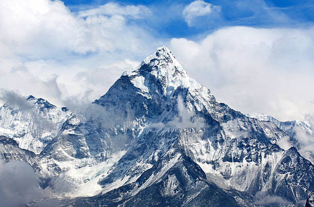
The scale of these subterranean mountains is almost incomprehensible. While Mount Everest stands 8.85 kilometers (29,035 feet) above sea level, the newly mapped peaks at the core-mantle boundary soar to heights exceeding 40 kilometers (24.8 miles). This makes them more than 4.5 times taller than Mount Everest from base to peak. Furthermore, the root structures of these mountains plunge even deeper, meaning their total vertical relief is far greater than anything found on the surface. The range itself is not a single chain but a sprawling, interconnected network of peaks that may rival or even exceed the surface area of any continental mountain range.
The composition of these deep-Earth mountains is a subject of intense study and debate. They are not made of granite or limestone, like surface mountains, but are likely composed of a different state of rock altogether. The primary theory suggests they are ancient, oceanic crust that has been subducted—pushed down into the mantle—over hundreds of millions of years. This crust, laden with dense basaltic rock, would have sunk to the bottom of the mantle, where the intense heat and pressure at the core boundary have transformed it into a new, ultra-dense mineral called bridgmanite. Dr. Kenji Tanaka, a geochemist from the University of Tokyo involved in the research, elaborates: “We believe we are looking at the graveyard of tectonic plates. These mountains are the recycled remains of ancient ocean floors that have accumulated over billions of years. They are a frozen record of our planet’s dynamic history, a history we are only just beginning to decipher.”
The existence and dynamics of these mountains have profound implications for the entire Earth system. They are not passive features; they play a critical role in driving mantle convection, the slow, churning motion of hot rock that drives plate tectonics on the surface. The immense mountains act as both a barrier and a catalyst for the Earth’s internal heat engine. Heat from the core wells up against these structures, creating massive thermal plumes that can lead to volcanic activity on the surface, such as the formation of hotspot chains like Hawaii or the massive outpourings of lava that create large igneous provinces. Conversely, the mountains can also disrupt and channel the flow of mantle material, influencing the very movement of the tectonic plates above.
The discovery also provides a potential answer to one of geology’s long-standing mysteries: the origin of certain “large low-shear-velocity provinces” (LLSVPs), two gigantic blobs of dense material deep in the mantle beneath Africa and the Pacific. These newly discovered mountains appear to form the complex, rugged “foothills” and peaks of these massive continental-sized blobs, giving them a defined topography rather than a simple, amorphous shape. This refined understanding helps scientists model how these deep structures have influenced the climate and geology of the surface for eons, potentially playing a role in the formation of supercontinents and mass extinction events.
For now, and for the foreseeable future, these monumental peaks remain inaccessible. The technology to physically probe such depths does not exist; the combination of immense pressure—over a million times atmospheric pressure—and scorching temperatures approaching those of the sun’s surface makes any direct observation impossible. They are a world known only through the elegant interpretation of seismic echoes. As Dr. Reed concludes, “This discovery is a humbling reminder of how little we truly know about our own planet. The greatest mountains on Earth have been hiding in plain sight, or rather, in profound darkness, all along. It forces us to look inward, not just outward, to find the final frontiers of exploration.” The tallest mountains on Earth have finally been found, not by scaling them, but by listening to the very heartbeat of the planet.


