May 12, 2026
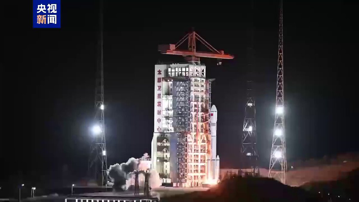
The silent expansion of China’s orbital surveillance network has reached a critical cadence, with the People’s Liberation Army (PLA) increasingly utilizing its sophisticated “spy satellites” to shape terrestrial geopolitics. The most significant development this month involves the Yaogan-50 series, specifically the successful insertion of the Yaogan-50 02 satellite into a sun-synchronous orbit via a modified Long March-6 rocket. While officially described by the China National Space Administration (CNSA) as a tool for “land survey and disaster prevention,” international intelligence communities recognize the Yaogan designation as the primary cover for China’s military reconnaissance program.
These satellites utilize high-resolution optical sensors and Synthetic Aperture Radar (SAR) to monitor global hotspots regardless of cloud cover or darkness. “The technical precision of the Yaogan series has transitioned from basic observation to high-precision physical measurement,” notes Gu Xingfa, chairman of the Chinese National Committee for Remote Sensing. “We are moving toward a database that can identify material fingerprints of objects on the ground from hundreds of miles away.”
The strategic utility of these missions has become a flashpoint in the ongoing 2026 Iran-Israel conflict. Recent reports suggest that China’s MizarVision and Jing’an Technology—private firms with deep ties to the PLA—have been providing geospatial intelligence to regional partners, allegedly tracking U.S. and allied naval movements in the Strait of Hormuz. Central to this is a high-resolution reconnaissance satellite developed by Earth Eye Co (Beijing Mumei Xingkong Technology). This satellite, reportedly acquired through a secret agreement in late 2024, has been identified by U.S. intelligence as a key asset for targeting and monitoring military installations across the Middle East. Despite denials from the Chinese Ministry of Foreign Affairs, the Biden-Trump transition team recently levied sanctions against Chang Guang Satellite Technology, the manufacturer of the Jilin-1 constellation, for allegedly facilitating this data transfer.
Beyond individual reconnaissance missions, China is aggressively deploying “mega-constellations” that blur the line between commercial internet and military utility. The G60 Starlink (also known as the Qianfan project) and the Guowang (Starnet) initiatives are scaling rapidly. In April 2026, a Long March 6A rocket successfully deployed the 21st group of low-orbit internet satellites, bringing the operational total to nearly 170. While these are intended to provide global broadband, their low-earth orbit (LEO) positions allow for persistent, low-latency “dual-use” surveillance. “The shift toward massive LEO constellations signifies a new era of space-based situational awareness,” says Liu Yunfeng, deputy director of the CNSA. “By 2030, we aim to achieve 95 percent real-time remote sensing coverage across all low-latitude regions, essentially ensuring nothing moves on the surface without being logged.”
Furthermore, the Wuyang Constellation project, managed by the Institute of Aerospace Remote Sensing Innovations, is preparing for its first “pioneer” satellite launch later this summer. This network is specifically designed to provide 30-minute emergency response capabilities across Southeast Asia, Africa, and South America. By focusing on a 1,008-satellite network, China is positioning itself as the primary provider of “space-based information services” for the Global South, a move that provides them with an unprecedented intelligence window into developing nations’ infrastructure and military assets. “These satellites aren’t just taking photos anymore; they are creating a real-time, intelligent service layer for government emergency response,” Gu Xingfa explains, highlighting the integration of AI-driven analysis directly on the orbital platforms to filter and transmit only the most relevant “targets” to ground stations.
As of today, the sheer volume of Chinese launches—reaching 23 missions already in 2026—has created a “congested and contested” environment in space. The integration of AI-driven biomarker identification and advanced signal intelligence (SIGINT) on these platforms has drastically reduced the “sensor-to-shooter” timeline. While the world watches the sky for scientific discovery, the reality of May 2026 is that the stars are increasingly populated by silent, high-definition eyes that have turned the entire planet into a transparent battlefield. “The integration of reusable rocket technology, like the recently tested Zhuque-3, will only accelerate this deployment,” observes space expert Kang Guohua. “China is no longer just catching up in space; it is setting the tempo for how orbital dominance translates to regional power.”


