
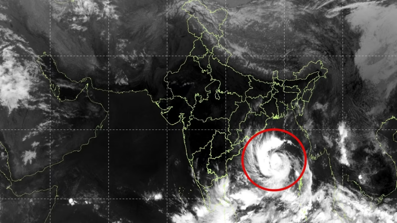
Satellite observations from NASA space assets, including the Visible Infrared Imaging Radiometer Suite (VIIRS) aboard joint satellites like NOAA-20, captured dramatic imagery of Cyclone Arnab as it tracked over the Bay of Bengal and made landfall along the eastern coast of India. The space-based view revealed the enormous scale, structure, and reach of the storm, providing atmospheric scientists and emergency managers with critical tracking data.
From low-Earth orbit, the imagery displayed a sprawling cloud shield that stretched far beyond the central eye of the tropical system. Before and during landfall, the satellite sensors captured a tightly organized spiral structure with severe convection. The bright, dense cloud clusters highlighted regions of deep convective activity, marking localized areas where intense rainfall and extreme thunderstorm activity were occurring simultaneously.
Even as the core of Cyclone Arnab crossed the coastline—impacting regions near Andhra Pradesh and neighboring coastal stretches—the imagery showed a massive plume of moisture sweeping inland. The extended feeder bands reached deep into central, eastern, and southern India, carrying tropical moisture across multiple states including Odisha, Telangana, and parts of West Bengal. This wide cloud envelope illustrated how the structural influence of a major cyclone remains active and dangerous long after the surface eye begins to break down over land.
Nighttime satellite pass imagery revealed the storm’s cloud tops utilizing infrared channels, mapping precise surface temperature differentials. Very low cloud-top temperatures, rendered as brilliant white and cold-enhanced regions in infrared imagery, indicated deep atmospheric updrafts rising high into the troposphere. These high-altitude cloud tops signaled sustained severe weather, heavy downpours, and violent wind gusts beneath the main storm canopy.
As Cyclone Arnab pushed further inland and began to weaken into a deep depression, satellite imagery continued to track its remnants. The imagery documented the atmospheric transfer of moisture toward northern and northeastern India, demonstrating the widespread distribution of heavy rainfall risks. NASA’s earth-observing fleet offered a comprehensive perspective on Cyclone Arnab, showcasing the power, size, and widespread footprint of the storm system across the Indian subcontinent.