Geomagnetic storms, stemming from dynamic solar activity, induce profound disturbances within Earth’s ionosphere, leading to the formation of plasma density irregularities often described as “bubbles” or “patches.” These irregularities, primarily Equatorial Plasma Bubbles (EPBs) and Sporadic E (Es) layers, severely disrupt radio wave propagation, impacting critical technologies such as Global Navigation Satellite Systems (GNSS), satellite communications, and high-frequency (HF) terrestrial radio. The increasing reliance of modern society on these interconnected technological systems has elevated space weather from a scientific curiosity to a critical societal concern. The substantial societal and economic ramifications of these disruptions necessitate a growing imperative for advanced space weather research and mitigation strategies, driven by both economic and national security interests.
The Mother’s Day geomagnetic storm of May 10-11, 2024, classified as a G5-class event, demonstrated profound and, in some cases, unexpected effects on the ionosphere. Notably, recent research from Kyushu University provided new insights into the significant enhancement of sporadic E layers at higher latitudes during this storm, challenging previous assumptions about their response to solar forcing. This recent event, alongside historical storms in September 2017, August 2018, and April 2023, underscores the dynamic, complex, and sometimes regionally asymmetric nature of ionospheric responses to solar forcing. The varied temporal characteristics of these storms also present distinct challenges for operational planning.
Current research is intensely focused on improving the predictability of these phenomena, with significant advancements noted in ionosonde-based techniques for EPB prediction and the development of new, strategically positioned observational missions. International collaborations and robust policy initiatives are increasingly recognized as crucial for enhancing global space weather resilience. While achieving Earth-weather-level predictability for space weather remains a long-term goal, continued investment in advanced forecasting models, the design of more resilient technological infrastructure, and coordinated international efforts are paramount to safeguarding modern technological systems against the escalating threats posed by this inevitable natural hazard.
The Dynamic Earth-Sun System
Defining Geomagnetic Storms and Their Solar Origins
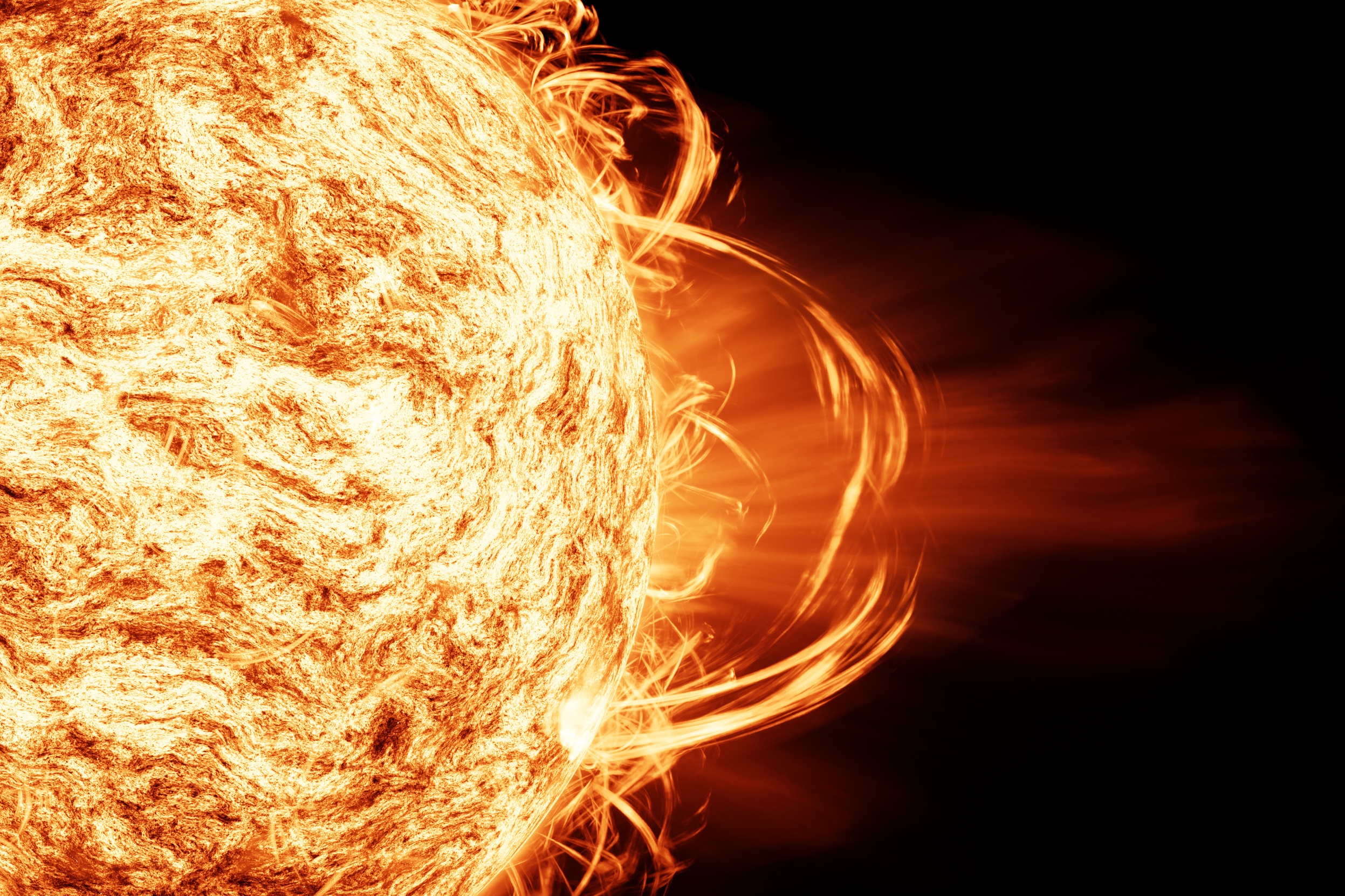
A geomagnetic storm represents a major disturbance of Earth’s magnetosphere, occurring when there is a highly efficient transfer of energy from the solar wind into the space environment surrounding Earth. This energy transfer leads to significant alterations in the currents, plasmas, and magnetic fields within Earth’s magnetosphere. The most effective solar wind conditions for triggering geomagnetic storms involve sustained periods of high-speed solar wind, lasting several to many hours. Crucially, the Interplanetary Magnetic Field (IMF) embedded within the solar wind must exhibit a strong southward-directed component (Bz). This southward orientation, opposite to Earth’s magnetic field at the dayside magnetosphere, facilitates magnetic reconnection, a fundamental physical mechanism that allows solar wind energy and particles to “pour in” to Earth’s magnetosphere. This understanding of Bz’s role is paramount for developing accurate predictive models, as it dictates the severity of the interaction.
The primary solar drivers of these storms are Coronal Mass Ejections (CMEs) and High-Speed Solar wind Streams (HSSs). The largest and most intense geomagnetic storms are predominantly associated with CMEs, which involve the expulsion of billions of tons of solar plasma and their embedded magnetic fields from the Sun. While CMEs typically take several days to reach Earth, the most intense storms have been observed to arrive in as short as 18 hours. These powerful ejections drive shock waves that continuously produce energetic particles as they propagate through interplanetary space. In contrast, HSSs, which interact with slower solar wind to create co-rotating interaction regions (CIRs), generally result in less intense storms than CMEs. However, HSS-driven storms can often deposit more energy into Earth’s magnetosphere over a longer duration. This distinction in temporal dynamics and impact profiles is critical for operational planning. A rapid, intense CME-driven storm might necessitate immediate, short-term protective actions, such as placing satellites into safe mode or reconfiguring power grids. Conversely, a prolonged HSS-driven storm, even with a lower peak intensity, could cause cumulative stress on systems, requiring sustained operational adjustments or longer-term contingency plans.
Geomagnetic storms generate intense currents within the magnetosphere, cause significant changes in the radiation belts, and profoundly alter the ionosphere. These ionospheric changes include heating, which can increase the density and alter its distribution in the upper atmosphere, particularly the thermosphere. A ring of westward current around Earth produces magnetic disturbances on the ground. Additionally, field-aligned currents connect to intense currents in the auroral ionosphere, known as auroral electrojets, which also generate large magnetic disturbances. The intensity of geomagnetic storms is quantitatively described using various indices. The planetary geomagnetic disturbance index Kp is a key measure, forming the basis for NOAA’s Geomagnetic Storm, or G-Scale, which classifies storms from G1 (Minor, Kp=5) to G5 (Extreme, Kp=9). The Disturbance Storm Time (Dst) index is another critical measure, with a negative Dst index indicating a weakening of Earth’s magnetic field, and a higher negative value signifying a stronger storm.
The Ionosphere: Earth’s Electrically Charged Atmospheric Layer
The ionosphere is the electrically charged region of Earth’s upper atmosphere, extending from approximately 50 km to over 1000 km altitude. This region is characterized by a significant presence of free electrons and positive ions, which are created by the absorption of solar radiation, primarily X-rays and ultraviolet light, by atmospheric gases. The ionosphere is broadly divided into several layers based on electron density and altitude: the D-layer (approximately 50-90 km), the E-layer (approximately 90-150 km), and the F-layer (approximately 150-500 km).
The ionosphere plays a critical role in terrestrial radio communication, particularly for high-frequency (HF) signals, by reflecting radio waves back to Earth, enabling long-distance communication. The ability of a radio wave to penetrate or be reflected by the plasma in the ionosphere depends on its frequency relative to the local plasma frequency. Waves with frequencies below the plasma frequency are reflected, while those above it can penetrate. The F-layer is primarily responsible for the reflection and propagation of radio waves during nighttime, when the D and E layers weaken.
During geomagnetic storms, the ionosphere experiences significant perturbations due to the substantial energy input from the magnetosphere-ionosphere interaction. This energy manifests in various forms, including enhanced electric fields, intense currents, and energetic particle precipitation. These processes lead to high-latitude ionization, Joule heating, ion-drag forcing, and disturbed electric fields, all contributing to the formation of ionospheric irregularities and strong plasma density gradients. The ionosphere’s response is not an isolated phenomenon; it is deeply interconnected with dynamics in the thermosphere and magnetosphere. For instance, the heating of the ionosphere also affects the upper atmosphere, known as the thermosphere. Furthermore, the formation of sporadic E layers is linked to disturbed neutral winds in the E region. This demonstrates a complex, multi-layered coupling where energy from the magnetosphere propagates into and influences the neutral atmosphere, which in turn affects the ionosphere. This necessitates a holistic, coupled system approach for accurate space weather prediction, rather than treating the ionosphere as a standalone entity.
The local heating and increased energy deposition during storms can increase the overall density and alter the distribution of density in the upper atmosphere, causing additional drag on satellites in low-Earth orbit. This highlights a dual impact of ionospheric changes during geomagnetic storms: direct disruption of radio signals and an indirect increase in satellite drag. While the primary focus may be radio disruption, the increased drag can lead to premature satellite re-entry or increased fuel consumption for orbital maintenance, adding an economic and operational burden beyond communication outages. This broader implication is crucial for satellite operators and space traffic management, as it points to multiple avenues of vulnerability that must be addressed.
Ionospheric Irregularities: The Science of Radio Disruption
Equatorial Plasma Bubbles (EPBs): Formation, Characteristics, and Impact on Radio Signals
Equatorial Plasma Bubbles (EPBs), also known as ionospheric plumes or Equatorial Spread F (ESF), are critical space weather phenomena characterized as regions of significantly depleted plasma density within the F region of the ionosphere. These irregularities typically originate and are most prominent in the post-sunset hours. Structurally, EPBs can extend for hundreds of kilometers in longitude and thousands of kilometers in latitude, often appearing as C-shaped wedges or plume-like structures when observed with airglow imaging or radar.
The primary mechanism for EPB formation is the Rayleigh-Taylor Instability (RTI). EPBs are initiated when mesoscale waves, such as Atmospheric Gravity Waves (AGWs), create a perturbation or “seed” in the bottomside ionosphere. If the ionosphere is sufficiently unstable and the RTI growth rate is large and positive, this perturbation will amplify and grow into a large plume of depleted plasma that extends vertically into the topside region of the ionosphere. The growth rate of the RTI is not solely dependent on local ionospheric conditions but on field-line integrated quantities, implying a broader influence.
The formation of EPBs is not a simple, direct consequence of a geomagnetic storm but results from a complex, multi-factorial interplay of various drivers. Key contributing factors to RTI growth include:
- Neutral Wind Dynamo and Pre-Reversal Enhancement (PRE): The global-scale neutral wind dynamo plays a crucial role by generating electric fields in the E region that cause a vertical E×B drift of the F region plasma at the magnetic equator. In the late afternoon, as the E region density decreases, the F region dynamo becomes more prominent, leading to a “pre-reversal enhancement” (PRE) of the eastward electric field. This PRE causes an upward vertical plasma drift, lifting the plasma to higher altitudes where the ion-neutral collision rate is low, thereby maximizing the RTI growth rate.
- Steep Density Gradients: The rapid decay of the E region ionosphere in the evening, coupled with the uplifted F region, creates a steep density gradient on the bottomside of the F region. This condition is crucial for the formation of the Rayleigh-Taylor instability.
- Geomagnetic Storms: Geomagnetic storms significantly influence EPB likelihood. Rapid changes in high-latitude regions, often associated with storms, can drive global ion and neutral distribution through Traveling Atmospheric Disturbances and Penetrating Electric Fields, which can either enhance or suppress bubbles depending on the longitudinal sector. Specifically, storm-induced Prompt Penetration Electric Fields (PPEFs) of eastward polarity can amplify the regular PRE, resulting in a more dramatic EPB development and substantial uplift of the ionosphere, leading to their expansion to higher latitudes.
- Other Factors: Additional factors influencing EPB formation include solar radiation (specifically Extreme Ultraviolet – EUV), global-scale waves in the neutral atmosphere (tides and planetary waves with multi-day periodicities), and even impulsive natural hazards like volcanic activity. Conversely, the presence of heavy metallic ions from smoke and meteoric debris in the E-region has been shown to suppress the likelihood of bubbles. Untangling the effects of these competing drivers is a key challenge, implying that accurate EPB prediction requires sophisticated, multi-parameter models that account for these interacting forces, making forecasting a significant scientific and computational challenge.
EPBs contain small-scale irregularity structures that cause rapid fluctuations in both the amplitude and phase of radio signals as they traverse the ionosphere. This distortion is widely known as scintillation. Severe scintillation conditions can prevent Global Positioning System (GPS) receivers from locking onto satellite signals, making accurate position calculation impossible or significantly reducing accuracy and confidence. This adversely impacts trans-ionospheric communications, as well as the continuous tracking of GNSS signals for position, navigation, and timing services. While EPBs are fundamentally equatorial phenomena, their disruptive effects can extend significantly to mid-latitudes, particularly during severe geomagnetic storms. Although the genesis is equatorial, the reach and impact zone can expand dramatically during extreme events, broadening the geographic scope of vulnerability for GNSS and communication systems. This challenges the common assumption that mid-latitudes are generally immune to severe ionospheric effects, necessitating a re-evaluation of regional risk assessments.
EPBs are detected and studied using a combination of techniques: direct in situ measurements of plasma density by satellites (e.g., COSMIC-2, Swarm constellation) and remote sensing based on radio wave propagation. Remote sensing methods include ground-based Global Navigation Satellite System (GNSS) observations, which characterize irregularities by the Rate of Change of Total Electron Content (ROT) and ROT Index (ROTI), and ionosondes, which perceive EPBs as “spread” or diffused echoes.
Sporadic E Layers (Es): Formation, Characteristics, and Impact on Radio Signals
Sporadic E (Es) layers are unique, vertically thin, only a few kilometers thick, but horizontally extensive, sometimes hundreds of kilometers, patches of unusually high ionization density that appear intermittently within the E layer of the ionosphere. The E layer itself is situated approximately 56 to 75 miles (90 to 120 kilometers) above sea level. Es layers are generally believed to be caused by the concentration of persistent metallic ions (e.g., Fe+, Mg+) in the E-region, which are acted upon by forces generated by wind shears, atmospheric tides, and gravity waves. Meteors are considered a primary source of these metallic ions.
The most widely accepted theory for mid-latitude Es formation is the wind shear theory. This posits that neutral winds, tides, and gravity waves create vertical shears in the horizontal wind, which, in conjunction with the Earth’s magnetic field, can converge and concentrate long-lived metallic ions into thin, dense layers. Historically, the sporadic E layer was considered largely unaffected by solar storms and thus received less study during such events. However, recent research has challenged this assumption, particularly following the Mother’s Day geomagnetic storm of May 2024.
Es layers can significantly impact skywave radio propagation by acting as a mirror to high-frequency (HF) and, occasionally, very-high-frequency (VHF) signals, such as amateur radio. The amount by which a radio signal’s path is refracted by sporadic E clouds depends on the intensity of ionization and the signal’s frequency. Above a certain critical frequency, known as the Maximum Usable Frequency (MUF), refraction is insufficient to return the signal to Earth. These vertically thin layers can also severely perturb Global Navigation Satellite System (GNSS) signals, causing low-Earth orbit (LEO) position and timing disruptions from Es-induced scintillation. While Es layers can reflect signals, they can also cause absorption, particularly for high-frequency radio signals when extra energy is delivered to the ionosphere, as seen during solar flares. The unpredictability of sporadic E occurrence remains a significant challenge, as its appearance is sporadic and its development mechanisms are still being fully understood.
Recent and Historical Geomagnetic Storms: Case Studies of Ionospheric Disruption
The Mother’s Day Geomagnetic Storm (May 10-11, 2024)
The Mother’s Day geomagnetic storm of May 10-11, 2024, was the strongest geomagnetic storm in the last two decades, reaching a G5 “Extreme” classification on the NOAA Space Weather Scale. It was characterized by a minimum Dst index of -412 nT and a peak Kp-index of 9. The storm originated from a sequence of coronal mass ejections (CMEs) from active region NOAA 13664, including X2.2 and X1-class solar flares, which merged and interacted as they traveled through interplanetary space, leading to enhanced effects at Earth. The solar wind bulk velocity reached over 1000 km/s, and a strong southward component of the Interplanetary Magnetic Field (Bz) was observed, which is crucial for intense geomagnetic activity.
Research from Kyushu University in Japan provided new insights into the storm’s activity, particularly concerning the E layer of Earth’s ionosphere. Contrary to previous assumptions that the sporadic E layer was largely unaffected by solar storms, the team, led by Huixin Liu, found that the E layer was significantly enhanced during the Mother’s Day storm. Thin patches of high ionization density, known as sporadic E layers (sporadic Es), suddenly appeared in the ionosphere. Data gathered from the joint U.S.-Taiwanese COSMIC-2 satellite network and 37 ground-based ionosondes revealed that sporadic Es formed after the main phase of the solar storm, during what is termed the “recovery phase”. These sporadic Es layers were initially detected at higher latitudes, near the poles, and then gradually extended towards the equator over time. This propagation characteristic suggests that sporadic E layers are most likely caused by disturbed neutral winds in the E region during geomagnetic storms. This finding is significant because sporadic E layers can disrupt HF (high frequency) and VHF (very high frequency) bands of radio communication, which are crucial for navigation and other applications. Understanding this phenomenon is vital for developing mitigation strategies to work around these disruptions.
Historical Precedents of Ionospheric Disruption
Historical geomagnetic storms have consistently demonstrated the profound impact of solar activity on Earth’s ionosphere and, consequently, on radio communications and other technological systems.
- September 2017 Storm: In early September 2017, a series of powerful solar flares (X-2.2 and X-9.3 class) and coronal mass ejections (CMEs) triggered a geomagnetic storm that caused significant radio blackouts. This event coincided with critical hurricane emergency response efforts in the Atlantic, highlighting the vulnerability of shortwave radio communications, which rely on signals bouncing off the ionosphere. The solar flares caused the ionosphere to absorb high-frequency radio signals, leading to communication outages for hours, described by amateur radio operators as “bacon fry in a pan” static followed by complete silence. Beyond direct flare effects, the geomagnetic storm on September 7-8, 2017, led to storm-enhanced development of postsunset Equatorial Plasma Bubbles (EPBs) in both the American and Asian sectors due to Prompt Penetration Undershielding Electric Fields (PPEF). These EPBs extended to significant latitudes (e.g., 30°N in the American sector and 46°N in the Asian sector) and caused severe ionospheric scintillations, impacting satellite-to-ground links. Interestingly, EPB development was inhibited in the Pacific sector due to the absence of F layer rise and the presence of disturbance dynamo electric fields with westward polarity. The observed westward drifts of EPBs in the Asian sector, increasing with latitude, further illustrated the complex storm-time ionospheric dynamics.
- August 2018 Storm: The geomagnetic storm of August 25-26, 2018, a significant event in the 24th solar cycle, reached a minimum SYM-H of –206 nT and an AE index peaking at 1500–2000 nT. This storm resulted in a significant increase in the intensity and spatial expansion of auroral ionospheric irregularities, forming an expanded oval-like shape that reached equatorward to approximately 55° MLAT in the nighttime sector and 60–65° MLAT in the dayside. Novel geostationary GOES GPS observations detected rapid Total Electron Content (TEC) variations, with intense fluctuations observed at various altitudes, from the E layer to the topside ionosphere (up to 1000 km). Ground-based ROTI maps corroborated these findings, confirming the presence of irregularities near the GOES GPS radio occultation sounding tangent points. This case study demonstrated the value of new observational techniques for continuous irregularity monitoring, particularly in regions with limited traditional facilities.
- April 2023 Storm: The severe geomagnetic storm of April 23-24, 2023, led to the formation of “super plasma bubbles” that expanded significantly from equatorial latitudes to middle latitudes in the European/African sector. These bubbles, associated with storm-induced prompt penetration electric fields, covered an area of over 5000 km and extended as far poleward as ~30°–35° latitude in both hemispheres. COSMIC-2 scintillation measurements showed intense amplitude scintillations (S4 above 0.8) across this entire region, indicating the presence of small-scale ionospheric irregularities within the extended plasma bubbles. This event notably caused degraded performance of the European Geostationary Navigation Overlay Service (EGNOS), with significant navigation errors recorded at its southernmost stations in Northern Africa, Spain, and Portugal, directly impacted by these super plasma bubbles.
These historical events, alongside the Mother’s Day storm, highlight that while ionospheric irregularities are most frequent and intense around the magnetic equator, their effects can extend to mid-latitude regions during severe geomagnetic storms. Past major geomagnetic storms have also demonstrated broader societal impacts, such as the temporary loss of electrical power over large regions, exemplified by the 1989 Quebec blackout and a blackout in Sweden during the October 2003 storm.
Societal and Economic Impacts of Radio Disruption
Critical Infrastructure Vulnerabilities
The increasing dependence of modern society on technology makes it more vulnerable than ever to the effects of geomagnetic storms. These storms can disrupt critical infrastructure and disable large portions of essential services.
- Global Navigation Satellite Systems (GNSS): Geomagnetic storms create strong horizontal variations in ionospheric density, which modify the path of radio signals and lead to errors in positioning information provided by GPS and other GNSS. Severe scintillation conditions can prevent GPS receivers from locking onto signals, making position calculation impossible, or reducing accuracy by several meters. This can cause “cycle slips” or, in extreme cases, total loss of signal lock. Such disruptions affect critical applications like precision agriculture, construction, surveying, and transportation.
- Satellite Communications: While not explicitly detailed in all sources, satellite communications are impacted by space weather, which can lead to total loss of communication due to attenuation and/or severe scintillation when broadcast signals cross the ionosphere. Satellites, particularly those in high, geosynchronous orbits used for communications, are vulnerable to damage from high currents discharging into them or high-energy particles penetrating components during storms.
- Electric Power Grids: Geomagnetic storms induce harmful geomagnetic induced currents (GICs) in power lines, which can lead to the saturation of magnetic core material within power transformers. Transformer saturation causes abnormally large currents and voltages, potentially damaging parts of the transformer due to induced ‘Eddy Currents’. This distortion can also cause protective equipment to trip unnecessarily, taking essential equipment offline and leading to voltage stability problems or widespread blackouts. This is most likely to happen at high latitudes and in regions with long power lines and poorly conducting ground.
- Aviation Industry: Solar flares, geomagnetic storms, and high-energy solar radiation storms can interfere with aircraft navigation and communication systems. Major radiation storms also pose a risk of heightened radiation exposure to passengers and crew, especially at high latitudes.
Economic and Operational Ramifications
The economic and social impacts of space weather disruptions are substantial and widespread. A 2017 NOAA-commissioned report highlighted these impacts across various sectors, including satellites and satellite communications, electric power distribution, the airline industry, and GNSS users. The electric power industry, for example, can avoid losses ranging from $111 million for minor geomagnetic disturbances to as much as $27 billion for severe geomagnetic storms through effective forecasts and alerts. Without these warnings, geomagnetic storms could damage critical transformers, leading to prolonged blackouts. The G5 geomagnetic storm in May 2024 alone caused a GPS outage during a crucial planting period, costing American farmers over $500 million in potential profit.
Beyond direct financial losses, extreme space weather events can disrupt supply chains for everyday goods and restrict human mobility, particularly due to temporary disruption of air travel. The potential for a “trillion-dollar storm” that could cripple communication networks and power grids for weeks or months, as a modern equivalent of the 1859 Carrington Event, is a growing concern. This underscores the critical need for proactive measures and investments in resilience, as the cost of inaction far outweighs the investment required for preparedness.
Current Research, Mitigation, and Future Outlook
Advancements in Space Weather Forecasting and Monitoring
Significant advancements are being made in space weather forecasting and monitoring to mitigate the impacts of geomagnetic storms. NOAA’s Space Weather Prediction Center (SWPC) and National Environmental Satellite, Data, and Information Service (NESDIS) play critical roles in monitoring and forecasting space weather through a coordinated network of satellites, ground-based observations, and advanced prediction models. Satellites like GOES continuously monitor the Sun’s activity, providing real-time imagery of solar flares and CMEs, and measuring space weather effects in Earth’s upper atmosphere. DSCOVR, orbiting at Lagrange Point 1 (L1), monitors solar wind in real-time, providing 15 to 60 minutes of advanced warning for geomagnetic storms. The Global Oscillation Network Group (GONG) delivers continuous images of the Sun, aiding in the prediction of solar eruptions.
Current research is intensely focused on improving the predictability of ionospheric irregularities. For EPBs, a robust ionosonde-based technique has been demonstrated, capable of predicting EPB formation with an accuracy of 99.86% using data collected about one hour prior to sunset. This approach is considered cost-effective for developing practical EPB prediction strategies. Furthermore, advanced methods using dense GNSS sensor networks are being developed to improve EPB detection and estimate their drift velocities, providing valuable insights into their dynamic behavior.
Looking ahead, future missions are designed to enhance monitoring capabilities significantly. NOAA’s Space Weather Follow-On (SWFO-L1) mission, scheduled for launch to L1 in 2025, aims to improve the detection of solar storms before they reach Earth, ensuring earlier warnings. The European Space Agency’s (ESA) Vigil mission, slated for 2031, will be positioned at Lagrange Point 5 (L5), offering a unique sideways view of the Sun-Earth line. This vantage point will allow scientists to monitor solar eruptions from the side, helping to detect the shape, speed, and crucially, the magnetic orientation (Bz) of incoming CMEs about a week in advance, a significant improvement over current warning times. NASA’s AWE mission (launching 2023) will provide measurements of Gravity Waves that can act as seeds for plasma bubbles, and the Geospace Dynamics Constellation (GDC) will study how high-latitude drivers control ion and neutral distribution at lower latitudes. While operational predictions are good, achieving Earth-weather-level predictability for space weather is estimated to take about 50 years, primarily due to the need for more comprehensive data from all sides of the Sun.
Strategies for Enhanced Resilience
Building resilience against space weather impacts involves a multifaceted approach encompassing technological advancements, robust policy frameworks, and international collaboration.
- Technological Mitigation: For satellites, operators can switch spacecraft to safe mode or safe hold when a significant geomagnetic storm is imminent, mitigating risks of damage or loss of attitude control. Improved space weather forecasts are essential for Low-Earth Orbit (LEO) satellites to ensure longer operational lifespans and reduce risks of premature re-entry or collision. For power grids, measures include hardening transformers, implementing protective systems, and developing robust regional risk analyses. Redundant systems and alternative power sources can ensure the continuation of critical services even during prolonged outages. Robust GNSS receivers are also being developed to maintain accuracy during scintillation events.
- Policy and International Collaboration: Governments and international bodies are increasingly recognizing the importance of space weather preparedness. The PROSWIFT Act and the National Space Weather Strategy & Action Plan in the U.S. identify objectives for a “space-weather-ready Nation”. NOAA collaborates with U.S. agencies like NASA and academic/private sector partners to expand capabilities. Internationally, organizations such as the United Nations Committee for the Peaceful Uses of Outer Space (UN-COPUOS), the World Meteorological Organization (WMO), the International Space Environment Service (ISES), and the Committee on Space Research (COSPAR) have established frameworks for coordination, aiming to minimize duplication of efforts and facilitate integration of space weather expertise. The International Space Weather Coordination Forum and International Space Weather Action Teams (ISWAT) are further initiatives to foster global collaboration and demonstrate the value of coordinated efforts.
- Sociotechnical Resilience: Beyond technological fixes, building sociotechnical resilience involves identifying shared control variables across interconnected critical infrastructures to sustain basic functions. This includes mapping out plausible scenarios for cascading impacts, such as a power outage affecting water pumps or critical communications. Organizational resources, such as built-in slack (excess resources and time) and redundant systems, are crucial for enhancing resilience, allowing for manual operation or alternative power sources if automated systems fail.
- Research Gaps and Future Directions: Despite advancements, challenges remain. Precisely geolocating ionospheric irregularities in remote sensing is difficult, and current GPS receivers on some satellites are not designed for high-rate radio occultation signal tracking, limiting accurate localization. Future geostationary satellites with advanced receivers hold great potential for enhanced ionospheric and space weather monitoring. Continued research and development are essential to understand the complex interplay of competing drivers for plasma bubble formation and to develop more comprehensive models.
In conclusion geomagnetic storms represent a complex and escalating natural hazard with profound implications for modern technological society. The recent Mother’s Day geomagnetic storm of May 2024, a G5-class event, underscored the dynamic and sometimes unexpected responses of Earth’s ionosphere, particularly the significant enhancement of sporadic E layers at higher latitudes. This discovery, alongside the well-documented impacts of Equatorial Plasma Bubbles (EPBs) during historical storms such as those in September 2017, August 2018, and April 2023, confirms that these radio-disrupting irregularities are not confined to equatorial regions but can extend to mid-latitudes during severe events, broadening the scope of vulnerability for critical communication and navigation systems.
The increasing dependence on satellite-based technologies, interconnected power grids, and high-frequency radio communications means that even moderate space weather events can have disproportionately large societal and economic consequences. The potential for multi-billion dollar losses, disruptions to essential services, and cascading infrastructure failures necessitates a proactive and integrated approach to space weather preparedness.
Significant strides are being made in space weather forecasting and monitoring, with new missions and advanced techniques offering improved warning times and prediction accuracy for ionospheric irregularities. However, achieving the level of predictability seen in terrestrial weather forecasting remains a long-term scientific and technological challenge, requiring sustained investment in data collection from multiple vantage points around the Sun and the development of more sophisticated, multi-parameter models.
Ultimately, safeguarding critical infrastructure against geomagnetic storm impacts requires a multi-pronged strategy. This includes continued investment in cutting-edge research to deepen understanding of the underlying physical mechanisms, the development and deployment of advanced monitoring and forecasting systems, the design and implementation of more resilient technological infrastructure, and robust international collaborations to share data, expertise, and mitigation strategies. By prioritizing these efforts, the global community can enhance its ability to withstand the inevitable challenges posed by space weather and ensure the continued functionality of the technological systems that underpin modern life.

