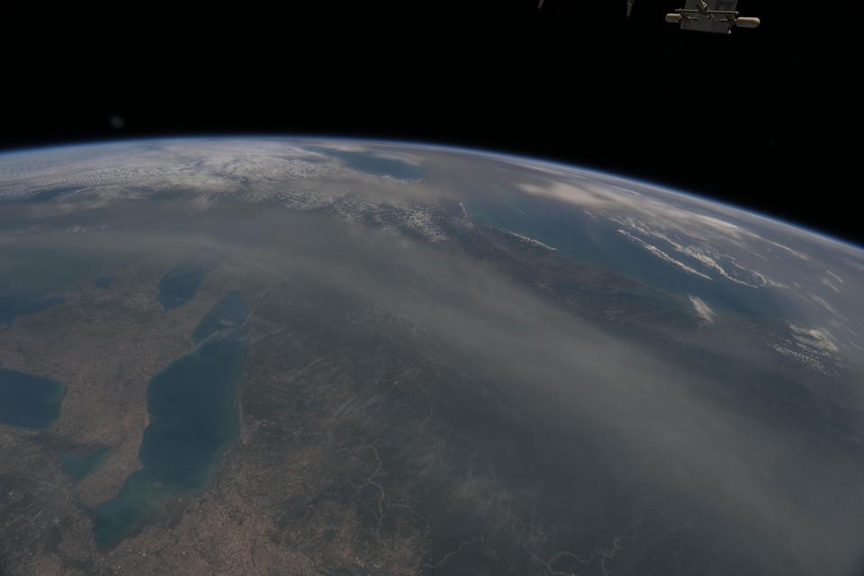
June 6, 2025, astronauts aboard the ISS have recently captured stunning views of vast dust and smoke clouds stretching over Canada and the United States. NASA astronaut Nichole Ayers shared on X (formerly Twitter), “I noticed smoke over the Northern U.S. and Canada a few days ago…almost looks like a differently colored cloud formation,” and has been photographing the phenomenon daily. Satellite imagery from NASA shows smoke plumes sweeping across parts of Canada into the U.S., forming brown-hued layers that overlay normal white clouds. This smoke has triggered air quality alerts across multiple U.S. states—including New York, New Jersey, Iowa, New Hampshire, and Maine—prompting health advisories for sensitive individuals. These observations are providing valuable insights into the movement and impact of these atmospheric phenomena.
Specifically, there are two primary sources for these significant clouds:
Wildfire Smoke from Canada:
NASA astronaut Nichole Ayers, an Expedition 73 flight engineer, has been documenting smoke plumes from Canadian wildfires, noting their distinct brown hue overlapping white clouds. These wildfires have caused evacuations in several Canadian provinces and impacted air quality across multiple U.S. states. The heat from these fires can generate pyrocumulonimbus (PyroCb) clouds, which lift smoke into the upper atmosphere, allowing jet stream winds to transport it widely.
Saharan Dust Plumes:
A colossal cloud of dust from the Sahara Desert has also made its way across the Atlantic Ocean, reaching the United States. This “Saharan Air Layer” can be several kilometers thick and is composed of minerals, organic remnants, and microscopic dust. While it can lead to hazy skies and vivid sunrises and sunsets, it also poses health risks, especially for individuals with respiratory conditions, as the microparticles can penetrate the lungs. Paradoxically, these Saharan dust clouds can also suppress the formation of tropical cyclones due to their dry air and ability to scatter moisture.
Both of these events are being closely monitored by various agencies, including NASA and NOAA, using satellite imagery and astronaut observations to track their progression and assess their environmental and health impacts.
