The operational encounter between Chinese naval forces and a United States Navy warship in the South China Sea represents a critical flashpoint in modern geopolitical maritime dynamics. The incident unfolded when the People’s Liberation Army (PLA) deployed military units to shadow, track, and issue severe warnings to an American naval vessel conducting operations in contested international waters. The confrontation involved the US Navy’s Independence-class littoral combat ship USS Charleston (LCS-18), which traversed the waters adjacent to Sabina Shoal (known as Escoda Shoal in Manila), a disputed feature situated within the Spratly Islands archipelago. Sabina Shoal sits roughly 87 miles (140 kilometers) off the coast of Palawan, placing it squarely within the Exclusive Economic Zone (EEZ) of the Philippines under the 1982 United Nations Convention on the Law of the Sea (UNCLOS). Despite international maritime conventions, the People’s Republic of China claims historic sovereignty over nearly the entirety of the South China Sea through its sweeping, unilaterally declared “nine-dash line” (or “ten-dash line”) maritime map, leading to direct military friction with the United States and regional partners like Manila and Taipei.
Following the detection of the USS Charleston, the PLA Southern Theater Command immediately dispatched naval units to track, monitor, and identify the warship, subsequently issuing formal warnings demanding its departure. A spokesperson for China’s military asserted that the American vessel had “illegally intruded” into waters surrounding the Spratly Islands without prior permission from the Beijing government, claiming that the transit infringed upon Chinese sovereign rights, threatened maritime security, and undermined regional stability. In response, Beijing reiterated that its maritime and naval forces remain on high alert status at all times to defend its perceived territorial sovereignty and maritime interests.
Conversely, the deployment by the United States forms part of its long-standing policy of conducting Freedom of Navigation Operations (FONOPs) and routinely maintaining a strategic military presence in the Indo-Pacific region. Washington and its regional allies maintain that the waters surrounding Sabina Shoal are international waters governed by international law, where all nations enjoy freedom of navigation and overflight. The United States Department of Defense consistently rejects Beijing’s expansive maritime claims, emphasizing that the 2016 Permanent Court of Arbitration ruling in The Hague concluded that China’s historic claims possess no legal standing under international maritime law.
The geographic focus of this encounter, Sabina Shoal, has rapidly emerged as a volatile, major operational hotspot in the South China Sea. Over recent months, the feature has been the site of repeated standoffs and aggressive maritime encounters involving Chinese Navy vessels, China Coast Guard ships, and maritime militia fleets confronting Philippine Coast Guard and supply vessels. The United States has repeatedly reaffirmed its binding defense commitments under the 1951 US-Philippines Mutual Defense Treaty, warning that an armed attack on Philippine public vessels, aircraft, or armed forces anywhere in the South China Sea would invoke mutual defense clauses. Consequently, the presence of American naval assets near Sabina Shoal acts as a deliberate strategic deterrence against Chinese military assertiveness.
To maintain tactical dominance over these disputed features, China has heavily fortified several artificial island installations across the Spratly Islands. These heavily fortified bases host forward-deployed naval ports, airstrips, high-tech radar and sensor arrays, as well as surface-to-air and anti-ship missile defense systems. This extensive military infrastructure enables the PLA Navy and Coast Guard to maintain a constant, dense maritime presence across the strategic shipping lanes, allowing them to rapidly deploy shadow ships whenever foreign military vessels transit the region.
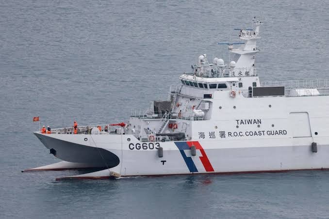
The tracking of the USS Charleston also highlights broader regional escalation, occurring concurrently with elevated maritime standoffs involving Taiwan’s Coast Guard near the Pratas Islands and expanding joint maritime cooperative activities conducted by the United States, Philippines, Japan, and Australia. While PLA air and naval forces continue to shadow US warships, the United States military continues to deploy complementary intelligence platforms, including P-8A Poseidon maritime patrol aircraft and MQ-9A Reaper drones, to monitor Chinese fleet maneuvers and safeguard open access to international waterways. Ultimately, the deployment and close tracking of naval forces in the South China Sea underscore the dangerous risk of tactical miscalculation, reflecting an ongoing superpower rivalry over freedom of navigation, international law, and regional stability in the Indo-Pacific.